
Groundwater represents a critical component of the global freshwater system, serving as a major source for drinking water, agriculture, and industrial processes. With increasing pressures from population growth, climate variability, and industrialization, sustainable water resources management is essential for ensuring long-term aquifer sustainability. Hydrogeology—the scientific study of subsurface water—provides the necessary framework to understand groundwater movement, distribution, and quality.
Aquifers, which are geological formations capable of storing and transmitting water, undergo continuous natural processes such as groundwater recharge and dewatering. These dynamic processes balance inflows and outflows, forming the basis of a comprehensive water balance study.
Key Concepts and Parameters in Groundwater Assessment
- Water Table Measurement: Determining the depth to the water table is pivotal for understanding aquifer levels. Techniques for precise water table measurement are integral during well drilling and subsurface water monitoring campaigns.
- Hydraulic Conductivity and Permeability Testing: These parameters quantify the ability of soil and rock formations to transmit water. Permeability testing informs soil permeability and influences decisions regarding groundwater recharge feasibility and well placement.
- Isotope Hydrology: This advanced analytical technique utilizes stable isotopes to trace groundwater ages, recharge rates, and flow paths, aiding in the detection of leachate migration and contamination sources.
Methods for Groundwater Exploration and Mapping
- Geophysical Surveying: Methods such as electrical resistivity tomography (ERT), seismic refraction, and electromagnetic surveys allow for non-invasive imaging of subsurface formations. These surveys provide insights into soil permeability and identify promising zones for good drilling.
- Remote Sensing: Satellite- and drone-based remote sensing technologies enable large-scale monitoring of groundwater-dependent ecosystems and surface indicators of groundwater levels.
- Hydrogeological Mapping: Incorporating spatial data from well logs, geophysical surveys, and remote sensing, hydrogeological maps outline aquifer boundaries, recharge zones, and flow patterns.
Techniques for Measuring Groundwater Quantity and Levels
- Water Table Measurement Instruments: Technologies developed by companies like Solinst Canada Ltd. and Thermo Fisher Scientific deliver automated water level monitoring with high temporal resolution, facilitating continuous subsurface water monitoring.
- Piezometers and Observation Wells: These structures enable direct observation of groundwater levels and hydraulic gradients. Regular measurement campaigns, often coordinated by the National Ground Water Association (NGWA), inform aquifer evaluation.
- Pumping Tests: Employed to evaluate aquifer response to extraction pressures, pumping tests inform permissible yield estimations crucial for sustainable water resources management. Parameters derived from these tests, such as drawdown and recovery rates, inform groundwater modeling efforts.
Assessing Groundwater Quality: Parameters and Testing Methods
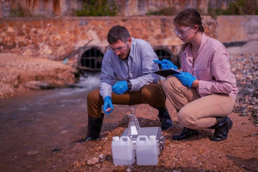
- Water Sampling Protocols: Accurate water sampling is crucial. Equipment from Hach Company and Palintest ensures standardized protocols that minimize contamination and preserve sample integrity for laboratory analysis.
- Chemical and Microbiological Analysis: Testing for parameters such as pH, dissolved oxygen, nitrates, heavy metals, and coliform bacteria informs water quality analysis. Advanced analytical tools from Thermo Fisher Scientific facilitate the detection of trace contaminants and emerging pollutants.
- Isotope Hydrology Applications: Isotope measurements reveal sources of groundwater contamination and processes driving water chemistry changes, offering insights into leachate migration and saline intrusion dynamics.

Use of Remote Sensing and GIS in Groundwater Assessment
Remote sensing and Geographic Information System (GIS) technologies have revolutionized aquifer evaluation and water resources management by enabling comprehensive, real-time analysis of subsurface water dynamics.
GIS further enhances groundwater assessment by integrating diverse datasets such as groundwater recharge zones, pumping test results, and well drilling logs from organizations such as the US Geological Survey (USGS) and HydroGeoLogic, Inc.
Modeling and Simulation Tools for Groundwater Management
Groundwater modeling is an indispensable tool for simulating aquifer behavior and predicting the impacts of water extraction or contamination events. Sophisticated software platforms developed by firms like Halliburton and Veolia Water Technologies allow for hydraulic conductivity and soil permeability parameters to be incorporated, providing dynamic models that reflect real-world subsurface water flow.
Models typically integrate pumping test data, permeability testing, and water balance studies to forecast aquifer sustainability under different scenarios. For example, groundwater modeling helps understand possible saline intrusion due to overextraction or the effectiveness of groundwater recharge efforts.
Integrating Groundwater Assessment into Sustainable Water Resource Planning
Sustainable water resource planning necessitates the seamless integration of multi-disciplinary groundwater assessment tools and methodologies. Comprehensive water balance studies that incorporate groundwater recharge rates, pumping test outputs, and hydrogeological data are essential for formulating long-term water conservation strategies.
Water resources management frameworks informed by groundwater modeling optimize well drilling layouts, identify critical recharge zones, and assess vulnerability to contamination or saline intrusion. Advanced GIS platforms enable policymakers to visualize aquifer status and project outcomes of various land-use or water extraction policies. Discover more by clicking this source.